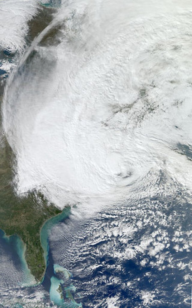
As of October 27, Hurricane Sandy, a storm so freakish it has been termed “frankenstorm”, had killed at least 38 people in Caribbean nations and was bearing down on the north-east of the United States. In the article below, first published at Think Progress on october 26, Stephen Lacey and Joe Romm take up the largely ignored role of climate change in creating a rising number of extreme weather events around the world.
* * *
As the US east coast braces for a possible direct hit from Hurricane Sandy, meteorologists are closely watching the storm’s “freak” formation. They’re calling it “unprecedented and bizarre”, a “perfect storm”, and a “frankenstorm” that could cause historic storm surges, last for multiple days, and cause more than US$1 billion in damage.
After hitting Jamaica and heading toward the Bahamas, it is likely that Sandy could swing into the US north-east and hit the coast somewhere between Washington, DC and Boston, affecting people all along the Atlantic seaboard. Projections for Sandy’s path are still uncertain, but models show that the threat is rising.
A confluence of factors are coming together to make the storm unprecedented. As Sandy moves through the Atlantic, it is expected to combine with an early winter storm from the continental US, causing pressure to drop ― potentially reaching pressure levels of a category three or four hurricane with winds over 115 miles per hour.
Brian Norcross of the Weather Channel described the storm this way on his Facebook page: “This is a beyond-strange situation. It’s unprecedented and bizarre.”
Another factor under consideration is climate change. Like a baseball player on steroids, our climate system is breaking records at an unnatural pace. And as with a baseball player on steroids, it’s the wrong question to ask whether a given home run is “caused” by steroids.
As Kevin Trenberth, former head of the Climate Analysis Section at the US National Center for Atmospheric Research, has written, all superstorms “are affected by climate change”.
Trenberth wrote in a September 24 Think Progress: “The air is on average warmer and moister than it was prior to about 1970 and in turn has likely led to a 5–10% effect on precipitation and storms that is greatly amplified in extremes.
“The warm moist air is readily advected onto land and caught up in weather systems as part of the hydrological cycle, where it contributes to more intense precipitation events that are widely observed to be occurring.”
The climate change link may be more than just more precipitation. A 2010 study by a Duke University-led team of climate scientists found: “Global warming is the main cause of a significant intensification in the North Atlantic Subtropical High.”
ClimateCentral.org’s Andrew Freedman explained in an October 25 article a possible influence: “Recent studies have shown that blocking patterns have appeared with greater frequency and intensity in recent years … While it is not unusual to have a high pressure area near Greenland, its intensity is striking for this time of year.
“As Jason Samenow of the Capital Weather Gang wrote on Wednesday, the North Atlantic Oscillation, which helps measure this blocking flow, 'is forecast to be three standard deviations from the average ― meaning this is an exceptional situation.'”
The storm comes at a unique time politically. In August, the Republican National Convention in Tampa, Florida was disrupted by strong rain and flooding caused by Hurricane Isaac. Two days later in his acceptance speech, Mitt Romney mocked President Obama’s pledge to deal with climate change and “slow the rise of the oceans” ― causing uproarious laughter among delegates.
And for the first time since 1988, the presidential candidates did not talk about climate change during debates ― even as data shows the US is experiencing the most extreme weather ever recorded. Meteorologist Jeff Masters explained in an April 17 Think Progress article: “The climate has shifted to a new state capable of delivering rare and unprecedented weather events.”